Rain and thunderstorm chances are expected to linger into the week across central North Carolina following a weekend of storm activity. On Monday, a cold front triggered scattered to numerous showers and storms in the afternoon and evening hours. The main threats were gusty winds and pockets of locally heavy rain.
Temperatures on Monday climbed into the mid-90s across the Triangle, with the heat index surpassing 105 degrees. A Heat Advisory was issued for much of the region as the extreme heat posed health concerns for vulnerable populations.
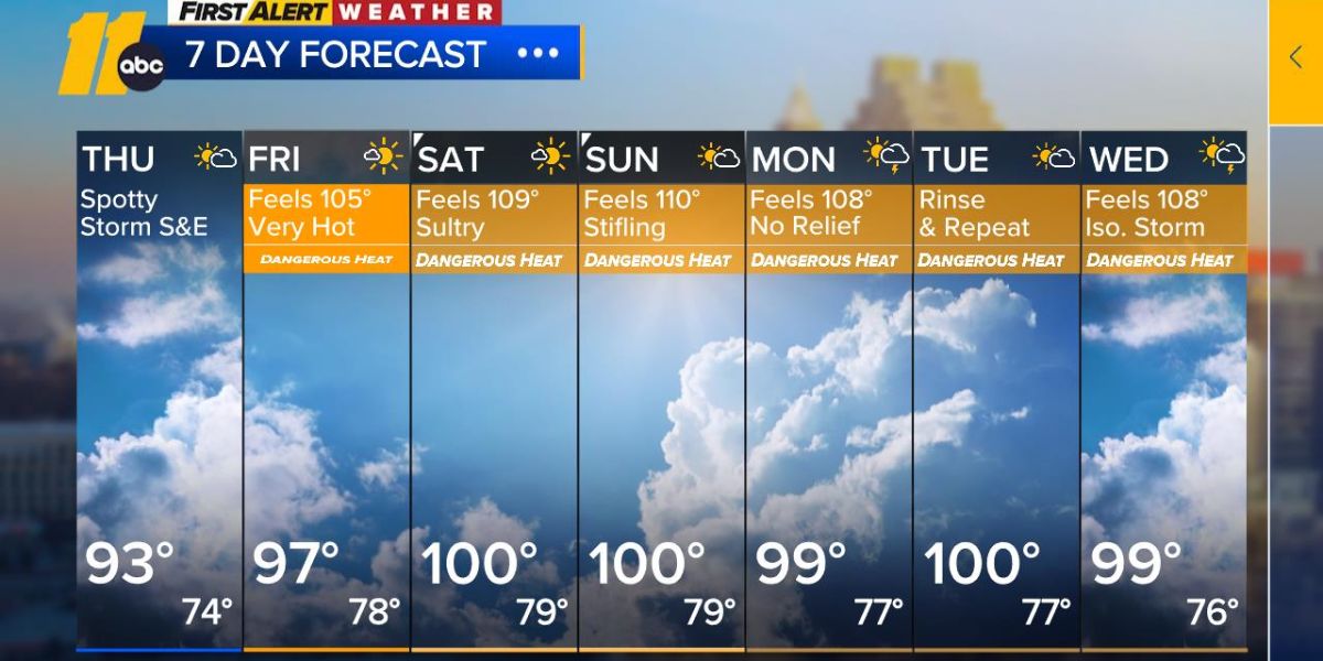
Detailed Forecast
- Cooler and less humid compared to Monday
- Highs in the mid to upper 80s
- A mix of clouds and sunshine
- A few morning showers possible, mainly south of the Triangle
- Drier conditions expected by the afternoon
Cooling Resources in Wake County
To help residents stay safe during the heat, cooling stations across Wake County remain open through at least Monday, July 21. However, not all public facilities are included.
- EMS stations, fire stations, and county fleet maintenance buildings are not serving as cooling centers
- Other designated public sites will be available for those needing a place to cool down
“Temperatures this high can be dangerous for anyone,” said Darshan Patel, operations manager for Wake County Emergency Management. “It’s important to find ways to keep cool during the hottest parts of the day, either by visiting a cooling station or taking a break in another air-conditioned space.”
With more rain and heat in the forecast, residents are urged to monitor conditions closely and take precautions to stay safe.


