A stretch of beautiful summer weather is gracing the region this week, offering a brief but welcome reprieve from the usual midseason heat and humidity. Clear skies, low humidity, and seasonably warm temperatures have combined to create ideal conditions for spending time outdoors.
Dew points, which hovered in the oppressive 70s over the weekend, have dropped into the low 50s. This significant dip in atmospheric moisture has brought a crisp, refreshing feel to the air, reminiscent of early fall. These conditions will continue through at least midweek.
While dew points will tick slightly higher by Wednesday, it won’t be until Thursday that the true summer humidity returns. That day will also mark the beginning of a major warm-up, with highs exceeding 90 degrees in some areas and heat index values rising into the mid-90s.
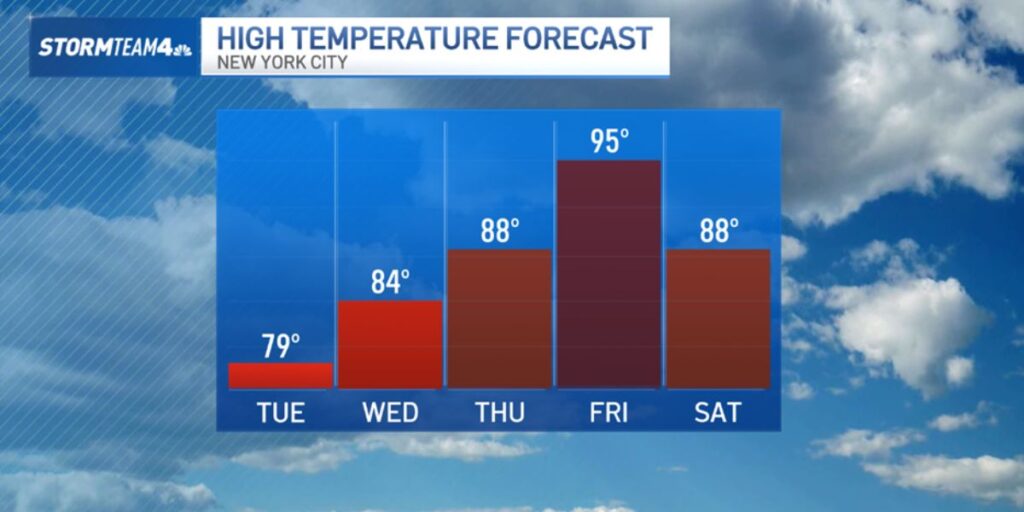
By Friday, the region will be facing potentially dangerous heat. Highs are expected to reach the mid to upper 90s, with “feels like” temperatures climbing into the low 100s. Such conditions can impair the body’s ability to cool itself, increasing the risk of heat-related illnesses. The National Weather Service is likely to issue heat advisories ahead of Friday.
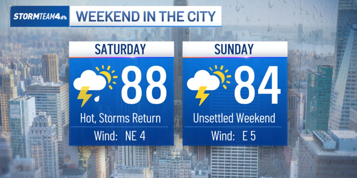
Storms are expected to return over the weekend, but the accompanying system will not bring substantial relief. Hot and muggy weather will likely persist into next week.
Residents are encouraged to take advantage of the current pleasant weather while it lasts. With sunny skies, low humidity, and a low to moderate rip current risk along the shore, this week provides a rare opportunity for outdoor activities in the heart of summer.


