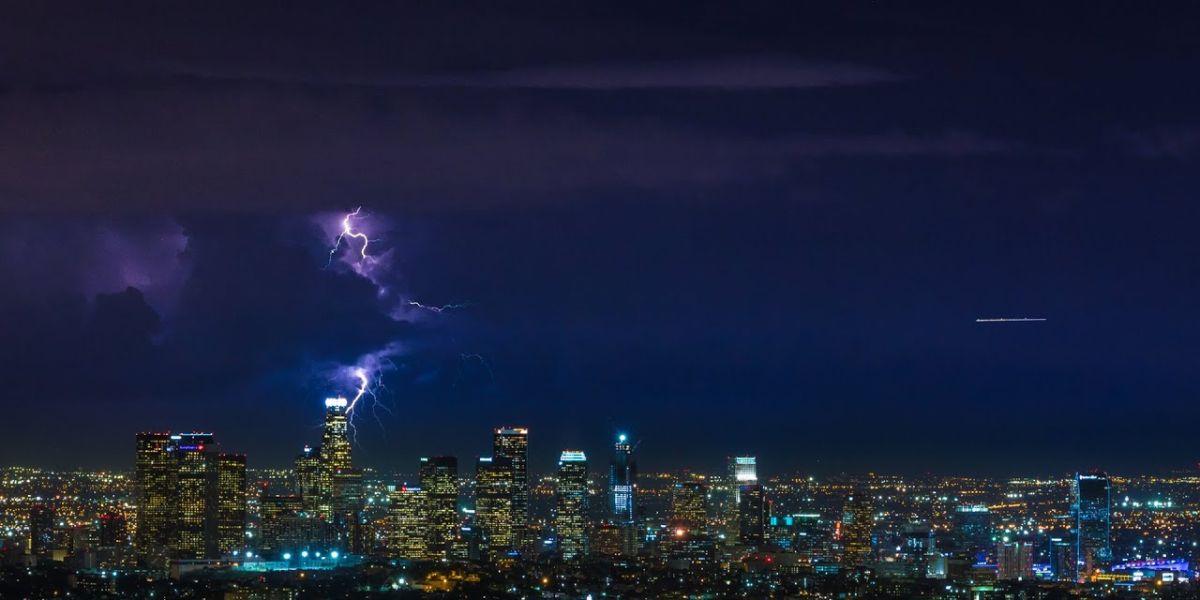
A surge of monsoonal moisture is bringing a slight chance of thunderstorms to parts of Southern California, with the National Weather Service (NWS) warning of possible flash flooding and fire weather concerns through Friday evening.
Thunderstorm Threat Friday Afternoon and Evening
According to the NWS, there is a 15% to 30% chance of monsoonal thunderstorms developing Friday, especially during the afternoon and evening hours as daytime heating increases instability in the atmosphere.
- Primary impact areas: San Gabriel Mountains, Antelope Valley, and Ventura County mountains.
- Localized flash flooding is possible, especially in mountainous regions and dry washes.
- Dry lightning could spark wildfires in vulnerable areas with dry vegetation.
“While storm coverage will be scattered, any storm that forms could produce dangerous conditions, especially for those in outdoor or elevated areas,” the NWS noted in its forecast.
Slight Risk for Foothill Communities
Although the greatest risk lies in the mountains and desert zones, foothill communities near these regions could also see isolated thunderstorm activity, especially if storm cells drift westward or southwestward with upper-level wind shifts.
Weekend Outlook
- Saturday: A stray thunderstorm remains possible in eastern Los Angeles County mountains, but most areas are expected to remain dry.
- Sunday: Conditions will calm even further, with near-normal temperatures and minimal storm activity forecast throughout the region.


